Tips for Data Collection
Don't see your question answered here? Contact CWW Project Manager, Ray Terracina (TerracinaR@si.edu).
FAQs when collecting data using the HydroColor App:
When can I make observations with the HydroColor app?
Any day is a great day to collect data! All data is good data, and your reports are always helpful. As long as the sun is high enough in the sky to avoid direct reflection from the water, you can collect data.
- During the winter, the best window for observations is 9AM - 3PM.
- During the spring and autumn, the best window is 10AM - 4PM.
- During summer, the best window is 9AM - 5PM.
When the sun is too high in the sky, the scattering of light off of the surface of the water can also cause issues with the app. Avoid making observations around 12 when the sun is directly overhead.
What are the best days and times to collect data?
That said, the best times are on clear sky days within one hour of when our project's partner satellites pass overhead.
There are three satellites with which our project coordinates:
Landsat 8/9 and Sentinel-2 fly over around 11AM during the winter or 12PM during the summer. Sentinel-3 also makes daily passes overhead, crossing the Chesapeake Bay at 10AM during the winter and 11AM during the summer. Data collected by Sentinel-3 can only be compared to water sample measurements that are taken at least 1/4 mile from land. Generally, this requires sampling water in the middle of larger rivers and in the main stem of the Bay.
Click here for the satellite calendar!
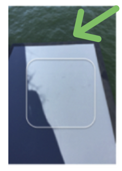
Can I retake a photo for the gray card, sky, or water?
- Yes, you click on the thumbnail outside the capture frame in the main menu (the one that shows all three pictures).
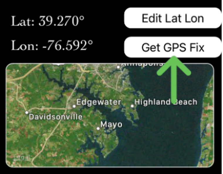
How do I get the best GPS accuracy on the iPhone?
- First, click “Get GPS Fix”. Then zoom in on the location map and make sure the “pin” is in the right position. If it looks not accurately placed, press “Get GPS Fix” again. Re-check your position. You may need to do this each time you start a new (replicate) collection series.
FAQs when entering or looking at data using Chesapeake Water Watch Fieldscope site:
How do I sign up for a Fieldscope account?
How do I enter data?
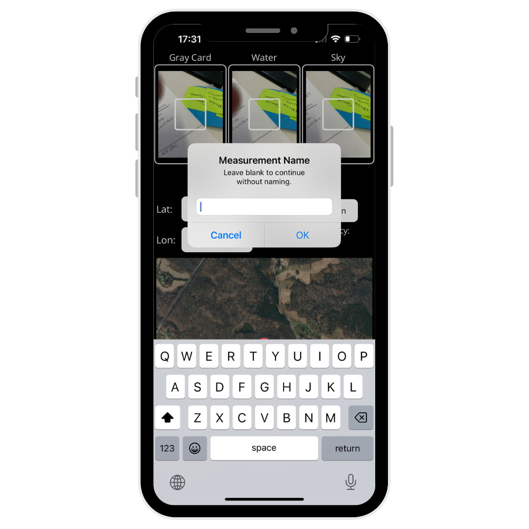
Why is my data entry missing a date or time when I collected data?
- Make sure you click OK after choosing your data entry time. If you do not click OK, your information will not be saved.
How do I edit my data entry? I forgot something or I entered information incorrectly.
How do I delete data entries?
- Click "Data" from the top menu.
- Make sure you are looking at the data you entered in "table" form.
- Click on the data entry you would like to remove. A side menu should appear.
- In the side menu that appeared, there is a "Review" button, click that.
- A box will appear that says "Leave a note for the project managers on why this data needs to be reviewed." Enter the reasoning why this data should be deleted or removed.
- Click submit. The project managers will review and delete the data entry if they feel it's necessary.
Sample Naming Protocol
This guide will tell you how to label your HydroColor observations, your water samples, and your stations in Fieldscope. Use the Chesapeake Water Watch River/Bay Naming Abbreviations table at the bottom of the page to find the initials associated with the body of water you sampled.
HydroColor
Enter: the initials of the body of water_unique identifier for your location_your initials_the measurement number
For example: this is Jane Doe's first measurement on the Rhode River at her pier, so her entry will read: RR_JanesPier_JD_1
Water Sample

Label your bottle.
Date, time, and your unique station name should be on the bottle.
Unique station naming protocol: the initials of the body of water_unique identifier for your location_your initials
Fieldscope Station Name
Unique station naming protocol: the initials of the body of water_unique identifier for your location_your initials
For example: Jane Doe is sampling the Rhode River off their pier so they are naming the station RR_JanesPier_JD

Use our interactive map below to find docks near you to sample from!
- Step 1: Enter your city in the search bar located at the top of the map. The map will zoom into that city. You can also click anywhere on the map to drop a pin on your desired location.
- Step 2: Select your radius (how far you are willing to travel) by using the dropdown below the search bar from step 1.
- Step 3: Click on the gray-outlined dot (or the red dot if you dropped your own pin) on the map to see a list of docks near you within the radius you selected in step 3. If you would like to change your radius, select another distance from the dropdown in step 2 and repeat step 3.
- Step 4: Click on the dock name that you are interested in to view more information and get its physical address. You can then click on the magnifying glass in the lower left corner to zoom to this dock on the map.
Chesapeake Water Watch River/Bay Naming Abbreviations
| Abbreviation | Name |
|---|---|
| AB |
Annemessex Bay |
| BR | |
| BRV | |
| BAN | |
| BL | |
| BB |
Blue Bay |
| BNB |
Brannock Bay |
| BRB |
Breton Bay |
| BU |