By Philip Kiefer
If you were to unravel the Chesapeake Bay shoreline, to smooth out every river mouth and tidal basin, it would stretch from New Jersey to Miami. This twisted shoreline, and the marsh behind it, is part of what makes the Chesapeake so productive: It’s an entire universe for young fish and crabs, a constellation of places to hide when soft and feed when hungry.
And it’s disappearing quickly. Anywhere from half a foot to 10 feet of Chesapeake marsh erode every year, depending on which shoreline you’re standing on. Lost marshes mean lost habitat for migratory birds, molting crabs, and young rockfish. Hundreds of islands have disappeared from the Chesapeake Bay in the last century, leaving behind tidal mudflats, sandbars, or open water.
Erosion eats human habitat too, so we’ve become experts at holding back the water. But many of our techniques for doing so are even worse for coastal ecosystems than unchecked erosion. Retaining walls and armoring stone (sometimes called riprap) hold back the waves, but provide little shelter for animals that live at the shoreline, like young rockfish and blue crabs — a problem called “shoreline hardening.”
So when the Smithsonian Environmental Research Center decided to save a piece of disappearing marshland on its own property, scientists had to take a more creative approach to preserve both soil and habitat.
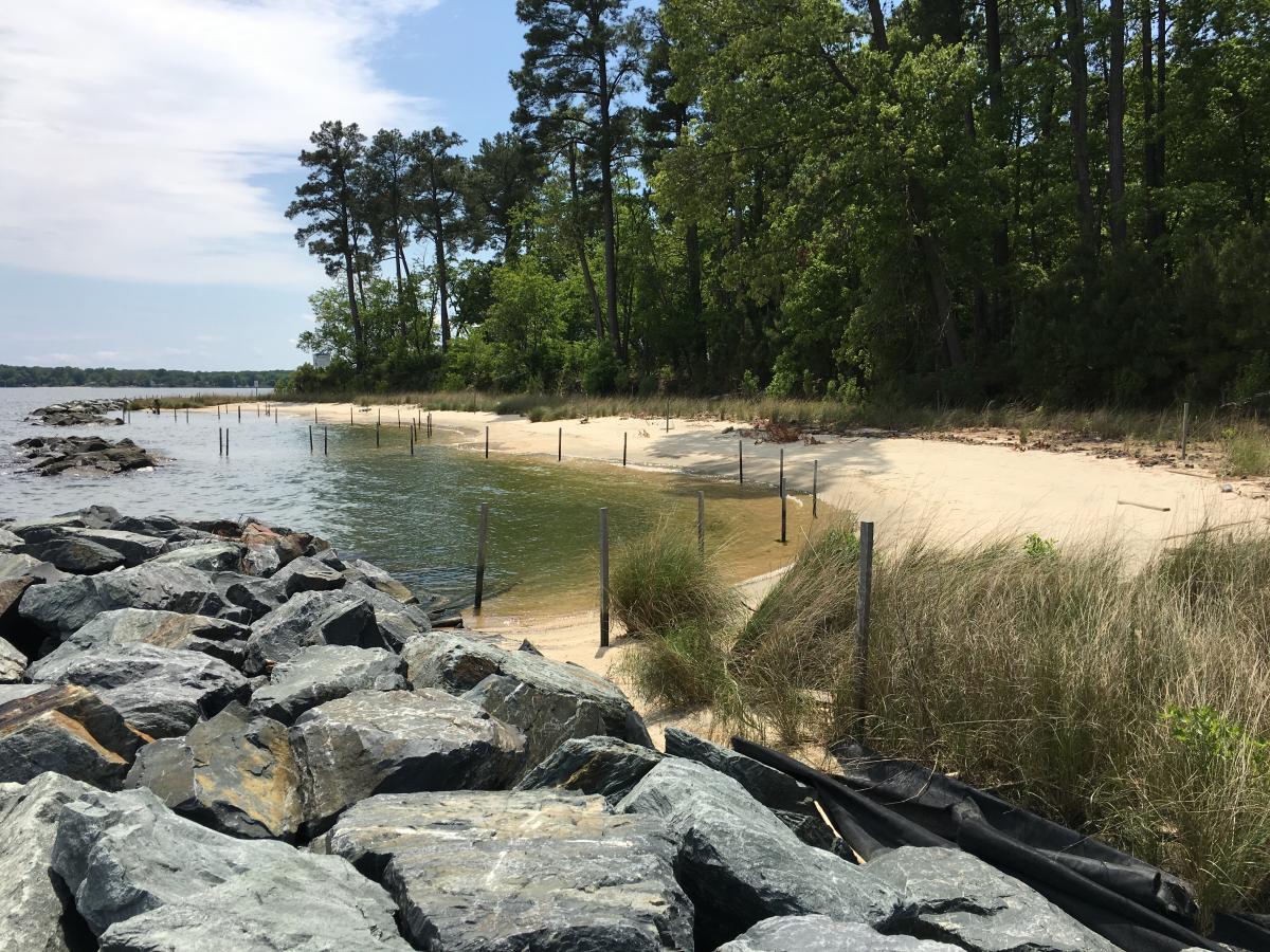
Cheston Point, on the southern end of SERC property, was disappearing rapidly in 2011. It’s at the mouth of the Rhode River, exposed to the full erosive force of the Chesapeake Bay, with its boat wakes, winter storms, and rising tides. Cheston Point is also a rare patch of undeveloped forest and marshland. Just across the river, the shoreline is dotted with marinas and private docks.
In 2012, SERC began to protect the point with money from the Environmental Protection Agency and the state of Maryland. But rather than just shore up the land with a bulkhead, SERC scientists engineered what’s called a living shoreline. Sam Benson, the SERC marine operations manager who led the restoration, says that with a living shoreline, “you’re effectively armoring the shore, but creating new shallow water habitat in the process.”