Research ProjectPlantation Layout

Archaeologists working in front of the Java Ruins
Affiliated Labs
Project Goal
SERC’s Environmental Archaeology Laboratory documents differences among Maryland’s planter elite. These men expressed their world views through choices in architectural and landscape design. The team is developing means of identifying and measuring these choices, choices which profoundly altered the local ecosystem.
Description
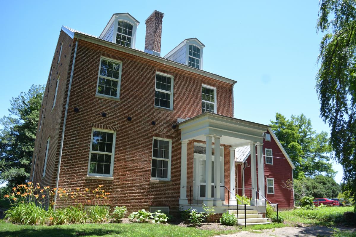
Volunteer scientist Kathleen Clifford seeks patterns in the layouts of the houselots of Maryland’s planter elite, including the two that survive on the SERC campus: Sellman House and Java. Between approximately 1720 and 1765 (Maryland’s Golden Age), wealthy planters throughout the Chesapeake Bay region created mansion houses on heavily modified landforms. They did so to inspire awe among non-elite members of society: slaves, artisans and mechanics, and the many farmers of lesser means who grew tobacco and other crops for the expanding world market. The planters also competed among themselves for prestige by designing landscapes and buildings that projected their taste and learning. The stakes were high. An elite family that demonstrated its knowledge of current fashions as well as a wide range of academic subjects—mathematics, botany, art and the rules of perspective, Greek and Roman art and literature—could gain remunerative positions in the Proprietary government of Lord Baltimore and negotiate for highly preferred marriage partners for their children.
Identifying patterns in architecture and landscaping at elite houselots provides insights into the differing understandings of the social and political world. Implementation of those ideas through the built environment significantly altered the local ecosystem of which it was a part. For example, virtually all Golden Age mansion sites are situated on rises with extensive views (now largely truncated by 20th-century reforestation). The rises are natural geologic features modified through the application of labor—slave labor. Each rise is terraced on one or more sides. The amount of soil moved was prodigious. Java was terraced on three of its four sides, although the south terraces are most prominent and easily seen. Sellman House has terraces on its east side, but they are not nearly as pronounced as those at Java. Its west yards also may have been terraced, but erosion has removed all but a few traces. Archaeological testing is revealing the locations and orientations of surrounding outbuildings and slave quarters.
The database of elite landscapes grows each week, drawing on LiDAR images (revealing terracing) and new archaeological research undertaken by practitioners throughout the region. We expect to define those patterns mathematically, although whether geometrically or algebraically remains uncertain.