Research ProjectSellman House Archaeology
Archaeological investigation of the Sellman house site

This is the Sellman House (or Homestead House) where the archaeology lab is situated. Photo by Samuel Lo.
Affiliated Labs
Project Goal
Measuring the effects of three households on the landscape over three hundred years
Description
This tract of land was patented in 1666 by the Shaw family (they called it Shaw's Folly) who held it until the Sellmans (who called it Sellman's Connection) acquired it in 1727. In 1917 the Kirkpatrick-Howat family (they called it Woodlawn) bought it. We are looking at how these three families altered the landscape, intentionally and unintentionally, over three centuries. Intentionally though terracing the yards and unintentionally through everyday use of the land.
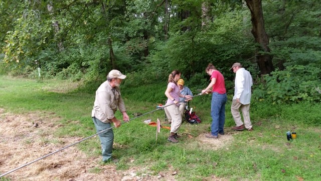
Archaeological investigations began in 2012 with close-interval shovel testing around the houselot. We used shovel testing to look at non-agricultural erosion and sedimentation and the use of coal. We also found large amounts of coal around the house leading to questions like why were the Sellmans using coal for fuel instead of wood when surrounded by trees?
Our survey data document the transportation of soils from a non-agricultural context to a point of redeposition. At the bottom of the hill across the road from the house we found a buried A horizon, or a buried surface, about three feet below the surface. (See Unit 11 tab). Check out the tabs below to learn more about the Sellman House.
Sellman House
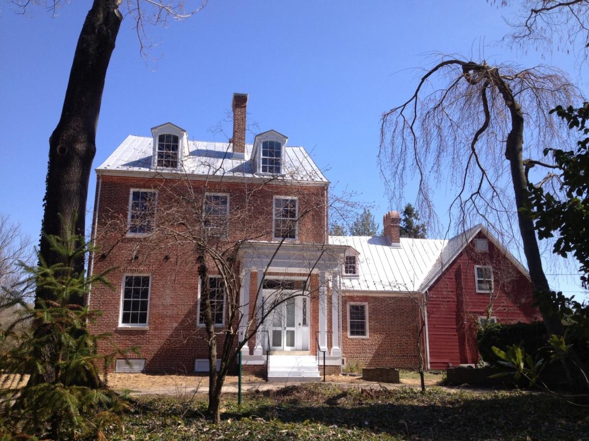
The Sellman House is the extant house consisting of three sections: the Northern section (left) dates to 1841, the mid-section dates to the 18th century, and the Southern section (right) is an addition added in 1979.
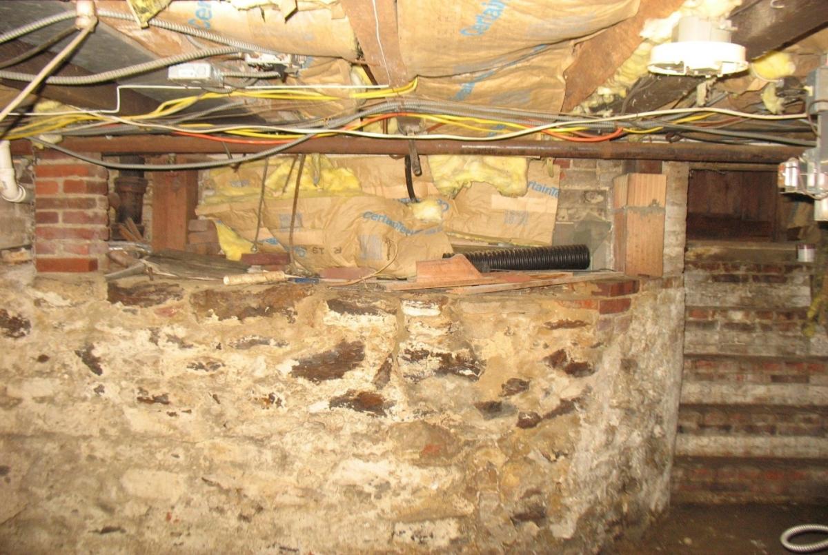
There is a foundation in the basement that pre-dates all of the extant portions of the house.

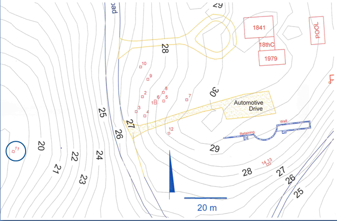
The blue dots in this image are our shovel test pits, 7 meters apart. It also shows the contours of the land, created using Surfer using point data taken with a total station.
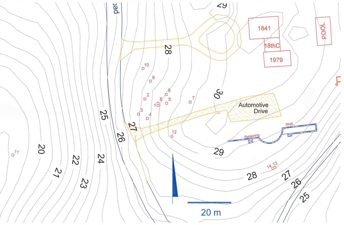
The red squares in this image are the numbers and locations of the excavation units.
Coal
Distribution of coal from the shovel test pit data was analyzed.

These contours were created in a program called Surfer looking at the distribution of count and weight of coal from shovel test pit data. Based on the contours, there is not a significant difference between count and weight throughout the site.
The use of coal makes us ask the question of why this family was using coal for fuel instead of wood and why? Further analysis will help answer these questions.
Unit 11
At the bottom of the hill and across the street from the Sellman house we found a buried A horizon, or an old surface, in a row of our shovel test pits. We needed to explore it further so we put unit 11 near the line of shovel tests.
The automotive driveway was a later addition, it's not parallel to the house like the other driveway, leading us to conclude it was added later and not repurposed for automobiles. The automotive driveway is heavily eroded, adding to the sediment in the area of unit 11.

A profile of unit 11 showing four feet of stratified sediment marking a series of erosional events. The black rectangles represent coal, few artifacts were found other than coal.
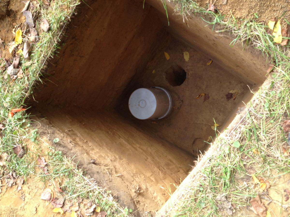

This was all that was found at the bottom of unit 11 (highlighted in red on the profile drawing), sherds of Potomac Creek pottery that dates to circa 700-1300 A.D. This allows us to roughly estimate the amount of time it took for four feet of soil to be deposited at the bottom of this hill.
Continuing Research
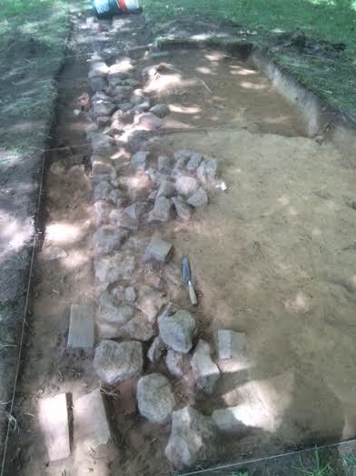
During our initial investigation of the Sellman site, we uncovered a brick foundation to the West (in the front yard) of the extant house. This foundation is only three courses deep, either having eroded away or it was cannibalized. We recently extended these excavation units to the South, towards the automotive driveway, and uncovered a larger stone foundation.

Through a grant, we partnered with professional geologist Bill Stephens to conduct soil research. We did soil cores and are in the process of analyzing the data.