Community Resources

CCN: Data Curation in R
This is a series of exercises to work on R tidyverse using CCRCN data. Learn to import, display, manipulate, and plot data with a set of human- and machine-readable commands.
Make EML with R and share on GitHub
This tutorial, courtesy of Colin Smith of EDI, introduces use of an R package that will facilitate the process of creating and organizing your metadata in EML format as a XML file. Unfamiliar with these acronyms? Give this a glance.
Data Carpentries Lessons
Data Carpentry aims to teach fundamental concepts, skills and tools for working more effectively with data. Much of the content that the CCRCN teaches is derived from the Data Carpentries suite of lessons.
RStudio Cheat Sheets
Why memorize syntax? This isn't a Chem 101 exam. Feel free to use a cheat sheet to remind you of the right commands-- RStudio has developed lots of helpful ones.
Predictive Soil Mapping with R
A great resource for geospatial processing in R catered towards pedalogists and geologists, derived from community efforts and responsive to new input.
Coastal Wetlands Methodologies and Protocols
Provided below is a set of guides and documentation relevant to the field and laboratory methods of wetlands research. Have suggestions of other resources to include here? Email us at CoastalCarbon@si.edu.
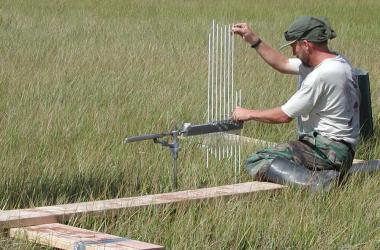
Overview of Surface Elevation Tables
This website presents information on the purpose, design, and use of the SET.
NAPT Regional Soil Testing/Analysis Methods
Learn more about region-specific methods for processing inland and coastal soil samples.ISCN Soil Science Resources Page
The International Soil Carbon Network (ISCN) has conglomerated a list of analysis labs, protocols, and collaborators to assist the community.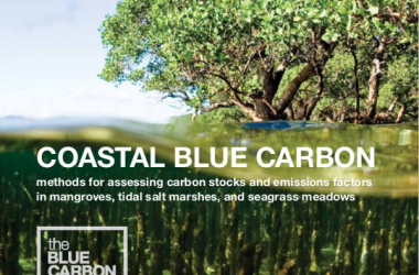
Blue Carbon Manual
Manual for measuring, assessing, and analyzing coastal blue carbon.
Coastal Carbon Protocols
Protocols for conducting carbon stock assessments and submitting data to the Coastal Carbon Atlas. Available in English, Spanish, and French.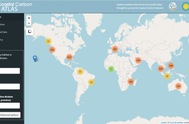
Users Guide to the Coastal Carbon Atlas
Tutorial for exploring, querying, and downloading data from the Coastal Carbon Atlas. Guía de Usuario para el Coastal Carbon Atlas
Tutorial para explorar, consultar, y descargar datos del Coastal Carbon Atlas.
Carbon Data Visualizations Across the Globe
From colleagues within the Smithsonian and beyond, here are a handful of interesting map products worth a visit.
Coastal Carbon Atlas
Use this map to visualize, query, and download data from the CCN Data Library.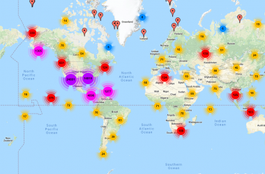
ISCN Data Access Map
The International Soil Carbon Network offers one of the most expansive databases on soil carbon stock and flux, which can be accessed through this map interface. Please familiarize yourself with the Data Information page before use. Note: users need to create an account to access this page.
Global Mangrove Soil Organic Carbon
Spatial predictions of soil carbon stocks under mangrove forests of the world. Product of Sanderman et al. 2018, Environmental Research Letters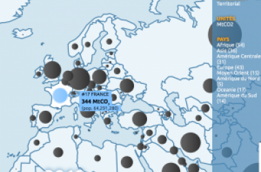
Global Carbon Atlas
An online platform to explore, visualize and interpret global and regional carbon data arising from both human activities and natural processes, hosted by the Global Carbon Project.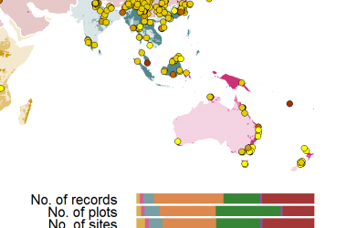
ForC Database Map
The Forest C database (ForC-db) is an open access global carbon database led by Dr. Kristina Anderson-Teixeira of the Smithsonian. It currently contains >17,500 records from >2,700 plots and >2,000 sites, making it the largest and most comprehensive database of its type.Training and Resources
One of the primary goals of the CCN is to provide training tools and tutorials for coastal carbon researchers. Here is a listing of the training products developed by the Network to date.
Collaborative Coding for Carbon Science
The CCN aspires to make coding a more enjoyable and collaborative process for all. We conform to tidyverse philosophies and grammar, which provides a unified methodology to approach R coding. Take a look at some of these tools and training developed by CCN managers as well as other developers from across the web.